|
Weihai Introduction
Weihai (Chinese: ÍţşŁ; pinyin:
W¨Ąih¨Łi), known in the past as the Weihai Garrison (Chinese:
ÍţşŁĐl; pinyin: W¨Ąih¨Łi W¨¨i) or Weihaiwei, and sometimes as
Port Edward during the colonial period, is a prefecture-level
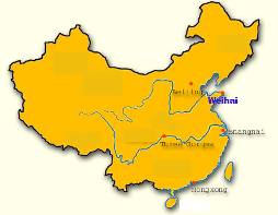
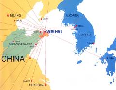
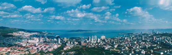
city in eastern Shandong province, People's Republic of China. It
borders Yantai to the west and looks out to the Yellow Sea to the
east.
Location
Administrative Divisions
The prefecture-level city of
Weihai administers 4 county-level divisions, including 1 district
and 3 county-level cities. They are Huancui District (»·´äÇř), Wendeng
City (ÎĵÇĘĐ), Rongcheng City (ČŮłÉĘĐ), and Rushan City (ČéÉ˝ĘĐ).
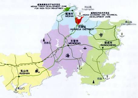
These are further divided into 66
township-level divisions, including 52 towns and 14 subdistricts.
Area and Population
The urban area of the city of Weihai covers 731 square kilometers
and has a population of 569,000. Together with the surrounding
administrative division, the total area occupied by Weihai is 5,436
square kilometers and the total population 2.47 million.
History
 The port
was once the base for the Beiyang Fleet of China during the Qing
Dynasty. In 1895, the Japanese captured it from the landward side.
It was evacuated in 1898. The port
was once the base for the Beiyang Fleet of China during the Qing
Dynasty. In 1895, the Japanese captured it from the landward side.
It was evacuated in 1898.
After Russia leased Port Arthur from
China on the opposite coast for 25 years in March, 1898, the United
Kingdom obtained a lease which was to run for as long as the
Russians stayed in Port Arthur. In 1905, when Japan took over the
lease of Port Arthur, the British lease was made to run as long as
the Japanese occupied Port Arthur. Thus the city was part of a
territory (c.285 sq mi/740 km²) called "Weihaiwei", which was leased
by the United Kingdom from 1898 until October 1, 1930.
The last British commissioner of
Weihaiwei was Reginald Johnston. It was briefly a special
administrative region after it was returned to the Republic of
China, the successor to the Qing Dynasty. In 1949, Weihaiwei City
was established to be renamed into Weihai City after the founding of
the People's Republic of China.
The nickname British sailors gave to
this port was "Way High"; it was also sometimes referred to as Port
Edward in English.
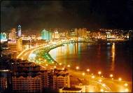
Geography and Climate
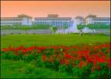 Weihai
is surrounded by sea on three sides and the harbor is protected by
Liugong Island. It is located on the north-eastern seashore of
Shandong Province in China at 37ˇă28ˇä0ˇĺN 122ˇă7ˇä0ˇĺE37.46667,
122.11667. Weihai
is surrounded by sea on three sides and the harbor is protected by
Liugong Island. It is located on the north-eastern seashore of
Shandong Province in China at 37ˇă28ˇä0ˇĺN 122ˇă7ˇä0ˇĺE37.46667,
122.11667.
Weihai has a mild, seasonal climate
moderated by the surrounding sea. August is the warmest month with a
24-hour average temperature of 24.3ˇăC and January the coldest
(24-hour average temperature of -1.5ˇăC.
Look at todayˇŻs weather report of
Weihai, please click
http://www.tianqi123.com/china,weather,forecast/chengshi_1658.html
Economy
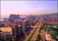
At present, Weihai is a commercial port and major fishing center
with some light industries. It is also a key production area for
peanuts and fruit. The output of aquatic products reaches 2.21
million tons, up 5.2%. The additional value numbered 23.37 billion,
up 18.5%. The market for domestic consumer products was prosperous
with total retail volume of social consumer products reaching 13.259
billion, up 13.4%.The finance and foreign trade developed
constantly. Great economic results were achieved.
Education
Weihai had 4 broadcasting stations with a broadcasting coverage of
86.6%; 4 TV stations with a TV coverage of 96.2%; 6 professional art
troupes; 6 newspaper offices; libraries museums, painting and
calligraphy studios, literature creation, archives, cinemas, and
dancing halls. With complete cultural facilities and orderly
cultural market, social cultural activities were colorful, literary
arts were fruitful and the achievements of foreign cultural
exchanges were conspicuous.
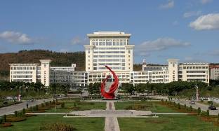
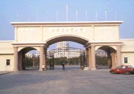
Campuses of Shandong University and Harbin Institute of Technology
are located there.
Transportation
Weihai International Airport serves the city with regular service to
Beijing, Shanghai, Guangzhou, Harbin domestically and the Korean
cities of Seoul and Busan. The N456 train departs everyday at 8:30PM
for Jinan, the provincial capital, and the No. 2518 goes directly to
Beijing. Internally, the city is served by 44 bus routes.
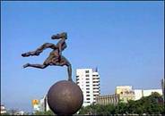
 City
Flower of Weihai City
Flower of Weihai
Laurels are evergreen bushes with luxuriant leaves. It blossoms in
middle autumn with a fragrance. It is a kind of bush suitable for
institutions, schools and residences. Laurels are resistant to
poisonous gas. Laurels grow well in the warm environment and under
the sunshine Laurels can grow on many kinds of soils.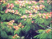
City Tree of Weihai
Silk tree is a deciduous arbor. Its crown is like an umbrella. The
leaves are thin and the shade of the tree is umbrella-shaped. With
clusters of red flowers, silk trees are pretty and special. Silk
trees are good for the neighborhood factories and mines with the
green color. Silk trees can grow in the barren and arid land, even
in cold regions. With an ability to solidify the earth, silk trees
can function as protective belt along an embankment. In May 1993,
the silk tree was determined as the city tree.

Symbol of Weihai
The symbol of Weihai is composed of C.W.H----English capital letters
of China Wei Hai. C has a curving edge in which there are blue
ripples. Liugong Island stands in the middle of the bay, meaning
Weihai is a beautiful coastal tourist city; W becomes deformed into
an ancient sailing boat, meaning Weihai is a historical coastal
defense spot. H is deformed into petals of the city flower which
form spectacular light rings around the sun, meaning that Weihai is
a garden city and the causes of Weihai are flourishing and
prosperous like the newlyrising sun.
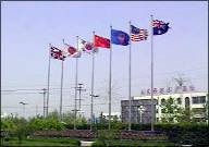
Sister cities
• Cheltenham, United Kingdom (since May 21, 1987)
• Ube, Yamaguchi, Japan (May 18, 1992)
• Santa Barbara, United States (December 8, 1994)
• Yeosu,South Korea,(February 17, 1994)
• Sochi, Russia (October 18, 1996)
• Biella, Italy (October 22, 1996)
• Timaru, New Zealand (July 30, 1998)
• Brazzaville, Republic of the Congo (May 24, 2004)
External links
• Government website of Weihai
www.weihai.gov.cn
(available in Chinese, English, Japanese and Korean)
• Weihai Sub-Council of China Council for the Promotion of
International Trade
http://en.whccpit.org.cn/ |